Horos
Orbits, Satellites, Space debris, SSA
This page provides technical documentation and a user manual on the HOROS app by Re CAE.


Technical Documentation
From the noun ορος (horos), meaning boundary in Greek, comes our English word horizon.
This Horos app is a pedagogical tool created by Re CAE to expand one's field of vision and raise awareness on space sustainability.
The main feature includes satellite tracking and real-time information on satellites and space debris. Powered by the extensive database from Celestrak, this app offers users a comprehensive and reliable source of data for tracking & monitoring objects in Earth’s orbit.
Celestrak provides a wide range of information about satellites and orbital element data. The main categories are:
Special-interest satellites,
Weather & Earth Resources satellites,
Communications satellites,
Navigations satellites,
Scientific satellites,
Miscellaneous satellites.
Each object then contain information such as:
International designator,
NORAD catalog number,
Name,
Period,
Inclination,
Apogees height,
Perigee height,
Eccentricity,
etc.
The information provided in the Horos app, (latitude, longitude, altitude & orbit) of a space object is based on standard TLE (Two Line Element) format orbital parameter descriptions.
User manual
HOROS by Re CAE is compatible with most iOS (iPhones & iPads). When the app is opened, the main page is presented as below.
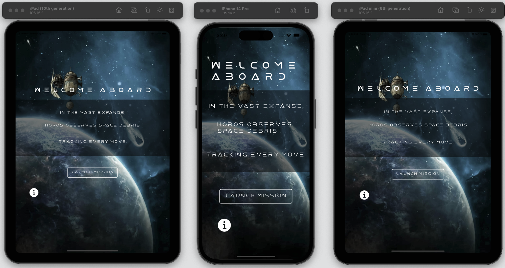
HOROS by Re CAE: Main page. Information button.

The information button opens a new page containing a brief description of space debris and features of the HOROS app. A documentation button will direct users to this page and a feedback button is made available for users to share constructive feedbacks;
Launch mission button

The “Launch Mission” brings users to outer space. By default, this page shows all of Starlink constellation and its current orbital position around the globe. Each satellite/debris is represented by a blue sphere. The “List” icon on the top right offers a list of satellites/debris wherefrom users can select/deselect the categories of spacecrafts to be displayed. When clicking on a sphere, information on the object will be displayed, namely its name, designation, current coordinates (Latitude, Longitude & Altitude) and its orbit.
FAQ
-
The presence of space debris in Earth's orbit can have several detrimental effects on satellite operations, including: panels, communication antennae, or sensitive instruments. Such damage can compromise the satellite's functionality and lifespan.
Collision risks
Satellite damage
Loss of communication
Impact on orbital availability
Chain reactions
Tracking and monitoring space debris play a crucial role in enhancing situational awareness and reducing the probability of collisions.
-
The database powered by Celestrak is updated in real time, ensuring the most up-to-date information available. The real-time data provides accurate and current information about the lcoation and trajectory of space objects, enhancing situational awareness.
-
The app is currently only available on iOS devices. The limitation is primarily due to the lack of available developers to work on other platforms. The team is committed to providing the best possible experience for iOS users for the moment. We do recognize the inclusivity and an expansion of platform is in view.
-
Horos V1 is a free app with the aim of developing a hollistic pedagogical tool to spread information on space situational awareness. If you like our work and want to support us, feel free to buy us a coffee here!
Roadmap
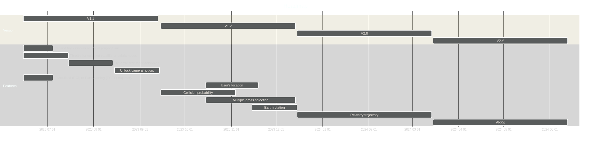
V1.1
Ground track display of orbital propagation.
Throttle for selected satellite or debris nodes
Dynamic size for observables.
Unlock camera motion.
Earth-fixed (ECI) or Earth-turning (ECEF) trajectory.
V1.2
Enable user’s location add-on and include user’s location with a location pin.
Collision probability.
Multiple orbits selection.
Earth rotation.
V2.0
Compute re-entry trajectory from current location.
V2.y
Artificial Reality kit to point and observe satellites currently passing above user’s location.